Most of my work has started with a practical conservation problem and grown from there: understanding what is happening, working with the people involved, testing an approach, and staying with it long enough to see what changes.
This page brings together selected projects from different stages of that work. You can browse them by theme, open any project for a short overview, and explore the full note for more detail, results, publications, and related links.
Projects
Shidvar Island Breeding Bird Conservation
Asian Houbara Power-line Collision Mitigation
Safe Passage for the Asiatic Cheetah
Rodent Control through Raptor Attraction
Isfahan Nest-box Programme
People, Behaviour & Community Conservation
Arjan Wetland Flagship Species & Community Conservation Programme
Fereydunkenar–Sarakhrud Hunting Reduction Programme
Bee-eater–Beekeeper Conflict Mitigation
Gavkhouni Wetland Biodiversity Platform
Isfahan Birdwatching Center
Mazandaran Waterbird Census
Hormozgan Waterbird Census
Fars Waterbird Census
Isfahan Waterbird Census
Taleghan Bird Survey
Policy, Governance & Conservation Systems
National Bird Guidelines
Updating Iran’s Waterbird Hunting Regulation
Reforming Songbird / Passerine Trapping Permits
Homa Environmental Grant
Species & Field Conservation
Shidvar Island Breeding Bird Conservation
Shidvar Island, Persian Gulf · 2020–2023 · Project Lead
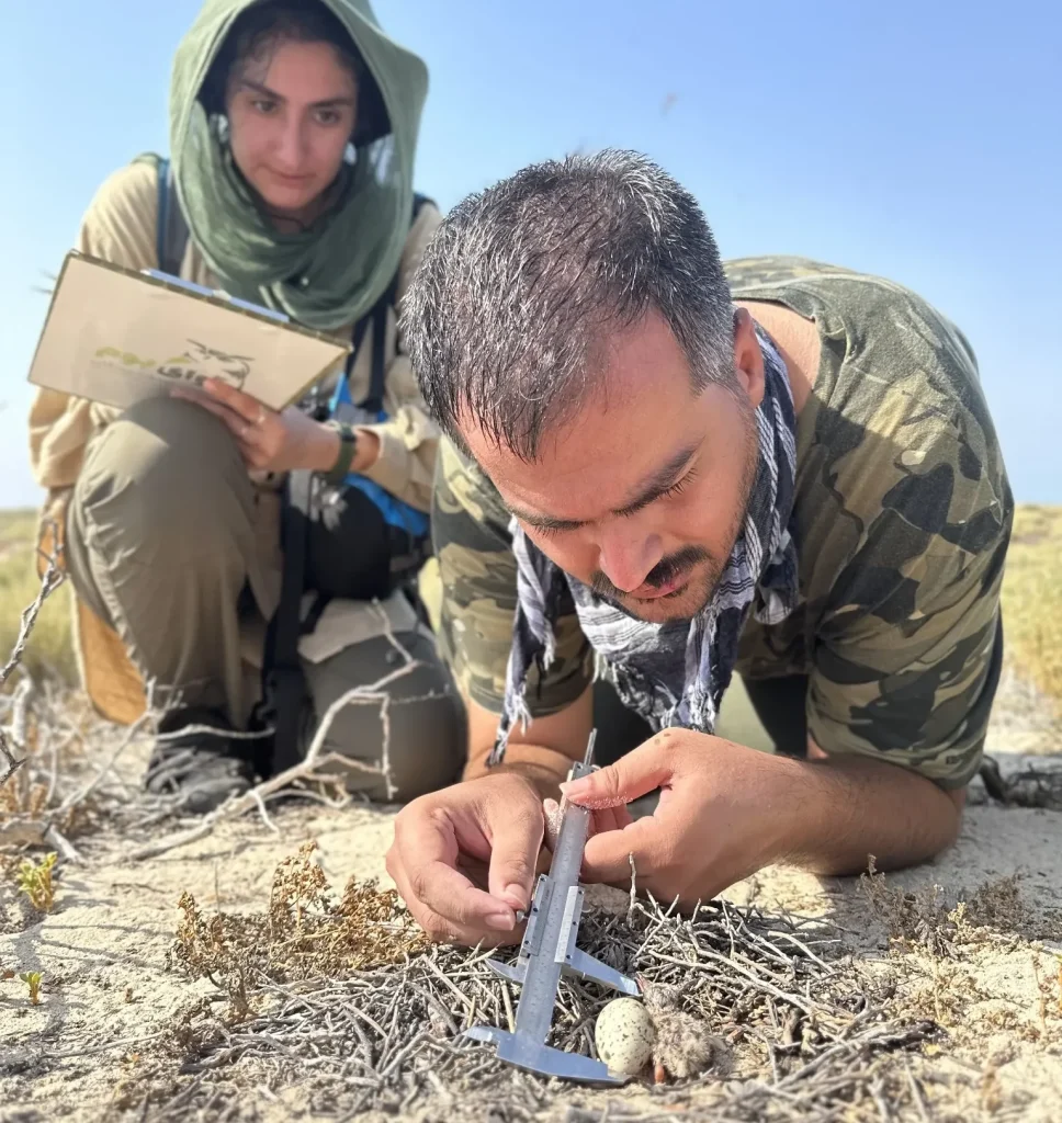
Shidvar is a small uninhabited island in the Persian Gulf and an important breeding site for seabirds. I led a multi-year conservation programme there combining breeding-bird monitoring, management planning, field research and direct conservation intervention.
One of the main threats was a population of feral cats. Between 2021 and 2022, we removed all 17 cats recorded on the island. Monitoring in the following breeding seasons showed a substantial shift in the clutch-size distribution of White-cheeked Terns, providing measurable evidence of the response following predator removal.
Asian Houbara Power-line Collision Mitigation
Abbas Abad Wildlife Refuge, Isfahan Province · 2019–2020 · Project Manager / Research Lead
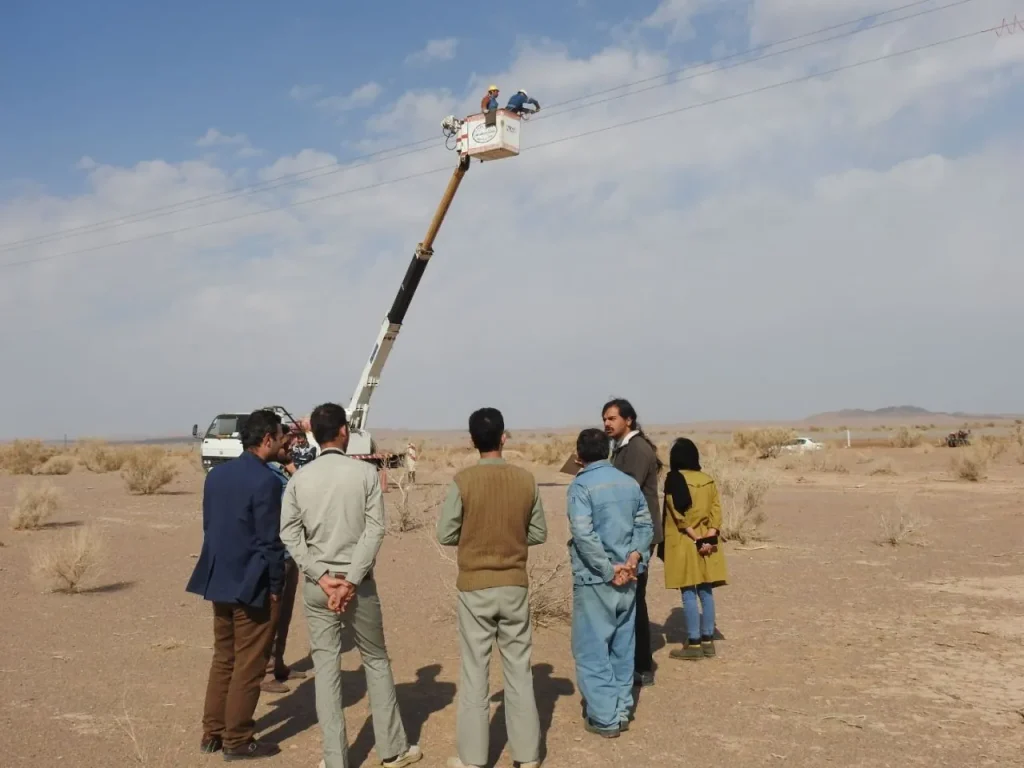
Power-line collisions were a recurring cause of mortality for Asian Houbara in Abbas Abad Wildlife Refuge. We monitored 21 km of power lines, identified the main collision hotspots, and used the results to target the sections where intervention was most needed.
We installed 450 spiral diverters along 7 km of high-risk lines and continued monitoring after installation. Nine collisions had been recorded during the baseline period; no collisions were recorded during the post-intervention monitoring period. The project later became the basis of a peer-reviewed study on the effectiveness of the intervention.
Safe Passage for the Asiatic Cheetah
Turan National Park / Miami–Abbas Abad Road · 2023–2024 · Management Team Member
At least 13 Asiatic cheetahs had been killed in vehicle collisions along the Tehran–Mashhad road, making road mortality one of the most immediate threats to the remaining population. The project focused on the high-risk road sections around the Turan landscape, one of the species’ most important remaining habitats.
I worked as part of the project’s management team alongside several Iranian conservation organisations. The proposed measures combined fencing of high-risk sections, improvement of existing culverts as wildlife crossings, speed reduction, road lighting where appropriate, and other measures intended to reduce collision risk.
The work brought together conservation organisations and government stakeholders around a practical road-safety problem affecting one of the world’s rarest large cats. My role was part of the wider management effort rather than direct leadership of the project.
Rodent Control through Raptor Attraction
Varzaneh / Gavkhouni Ramsar Site · 2020–2021 · Project Manager
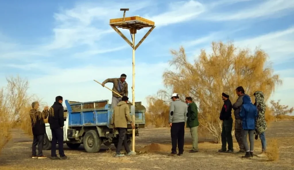
Rodent pressure around agricultural areas near Gavkhouni created an opportunity to use native predators as part of the response. The project focused on encouraging raptors to use the landscape more regularly, particularly in areas affected by Persian gerbils.
We installed species-appropriate nest boxes and raptor perches and identified areas where birds could forage with lower disturbance. Target species included Long-legged Buzzard, Common Kestrel, Lesser Kestrel and Barn Owl.
The project was designed as a practical ecological alternative to relying only on direct rodent control, while also strengthening the role of native birds of prey in local land management.
Isfahan Nest-box Programme
Isfahan · From 2016 · Project Manager
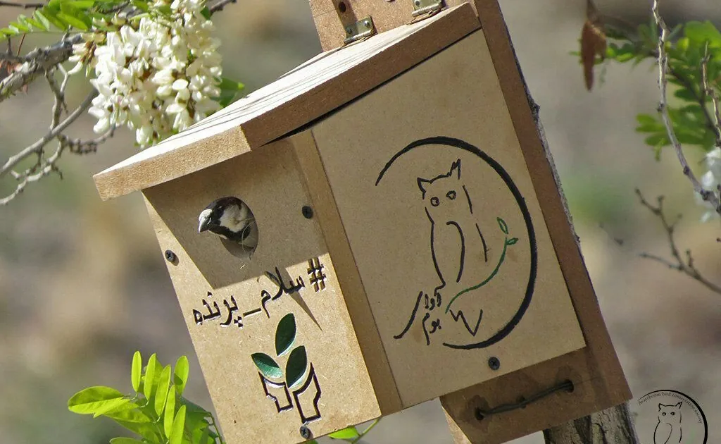
The Isfahan Nest-box Programme began as a practical urban bird-conservation initiative and developed over several years into one of the largest public-engagement campaigns around birds in Iran. We designed and installed species-appropriate nest boxes across different parts of the city, while also encouraging residents to install, monitor and care for nest boxes themselves.
Dozens of citizens became directly involved. People regularly shared photographs of occupied nests, eggs and chicks on social media, and the project gradually created a visible community around the birds breeding in gardens, neighbourhoods and public spaces. This public participation became as important to the programme as the nest boxes themselves.
A subsequent study found that 73% of the monitored nest boxes were used by birds, across several species. Beyond providing nesting opportunities, the programme showed how a simple and tangible intervention could bring people into repeated, close contact with urban wildlife and turn bird conservation into something they could take part in directly.
People, Behaviour & Community Conservation
Arjan Wetland Flagship Species & Community Conservation Programme
Arjan International Wetland, Fars Province · 2020–present · Project Lead / Lead Researcher
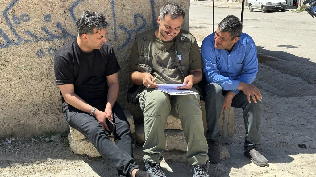
Arjan began with a question that has shaped much of my later work: whether conservation can become more durable when people develop a stronger relationship with a species and the place it represents. We developed a ten-criteria framework combining ecological, social and cultural factors and selected the Ruddy Shelduck, locally known as Anghut, as a flagship species for the wetland.
The programme then moved from species selection into long-term conservation practice. Work with schools, local organisations and residents has included public events, murals, village signage, birdwatching, habitat-related interventions and repeated social and ecological monitoring. Recognition of the species and positive attitudes towards it increased substantially, local participation expanded, and annual counts rose from 312 Ruddy Shelducks in 2023 to 1,326 in 2026, alongside changes in hydrology and habitat conditions that also influence the population.
Fereydunkenar–Sarakhrud Hunting Reduction Programme
Mazandaran Province · 2026–present · Project Lead
Fereydunkenar is one of the most difficult bird-conservation landscapes I have worked in. More than a million migratory birds are hunted in a relatively small area, within a system shaped by livelihood, tradition, local power, enforcement history and rapidly changing hunting technologies.
My work here focuses on understanding that system before trying to change it. The programme combines research on attitudes, values and willingness to change with field assessment of hunting practices, stakeholder engagement, and the development of locally workable alternatives. A central part of the current approach is building a stakeholder council and testing birdwatching and swan-based tourism as a practical alternative linked to the wetland economy.
The project is still in its early stages. The research and intervention are being developed together, with the aim of testing what can realistically reduce hunting pressure in this landscape. Results from the research and the conservation interventions will be published as the work progresses.
Bee-eater–Beekeeper Conflict Mitigation
Iran · 2021–2023 · Project Lead / Research Lead
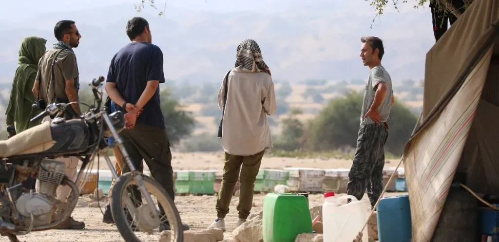
Conflict between beekeepers and bee-eaters is widespread in parts of Iran and can lead to direct persecution of the birds. We developed a field-based intervention that worked directly with beekeepers, combining information about bee-eater ecology with practical, apiary-specific recommendations for reducing conflict without killing birds.
Seventy-eight beekeepers participated in the intervention and 57 were followed up approximately one year later. Among those followed up, 73.7% reported that conflict had decreased and 72.2% of respondents to the relevant question reported using at least one of the suggested measures. Because the study had no untreated control group and relied on self-reported outcomes, these results are treated as evidence of reported change rather than proof that the intervention alone caused it.
Gavkhouni Wetland Biodiversity Platform
Gavkhouni International Wetland, Isfahan Province · 2021–2023 · Project Manager
The Gavkhouni platform was developed as a shared public resource for a wetland whose ecological decline had often separated scientific information from local knowledge and public experience. The project brought together residents, NGOs, rangers, government agencies, tour guides and conservation experts to document the biodiversity and cultural landscape of the wetland.
The platform combined species information, scientific publications, photographs, local stories, children’s paintings, stakeholder perspectives and a virtual wetland tour. An important part of the project was its governance: responsibility for the platform was progressively transferred to local stakeholders, while AvayeBoom moved into a supporting role after the main development phase was completed.
Isfahan Birdwatching Center
Mount Soffeh, Isfahan · 2017–2019 · Manager
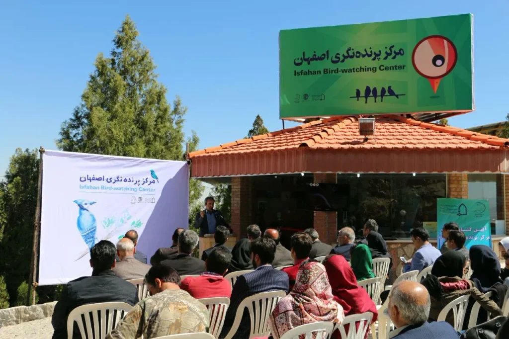
The Isfahan Birdwatching Center was developed at Mount Soffeh as a dedicated place for introducing people to birds and responsible birdwatching. I managed the centre during its early years, when organised birdwatching was still relatively unfamiliar to much of the public in Iran.
The centre combined short urban birdwatching trips with training in bird identification, binocular use, responsible observation and simple ways of making urban spaces more bird-friendly. It created a physical place where people could encounter birdwatching as both recreation and conservation practice.
For me, the value of the centre was its role in making birds accessible. It brought conservation into an everyday urban setting and helped turn birdwatching from a specialist activity into something that families, students and nature guides could experience directly.
Monitoring & Applied Research
Mazandaran Waterbird Census
Mazandaran Province · 2026 · Project Manager
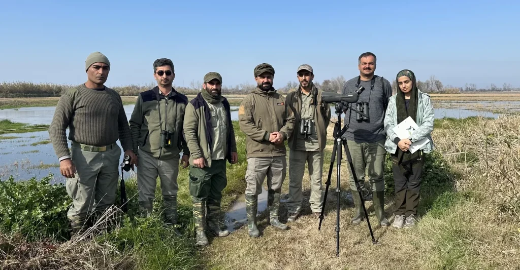
The 2026 Mazandaran census covered 36 wetlands and other waterbird sites over ten days of fieldwork. The survey recorded 54,889 waterbirds representing 112 species and was conducted in collaboration with the provincial Department of Environment.
The programme also included training for volunteers and Department of Environment personnel in waterbird census methods. Beyond producing an annual count, the work focused on improving the consistency and practical use of monitoring data so that census results could contribute more directly to wetland and waterbird management.
Hormozgan Waterbird Census
Hormozgan Province · 2021–present · Project Manager / Field Expert
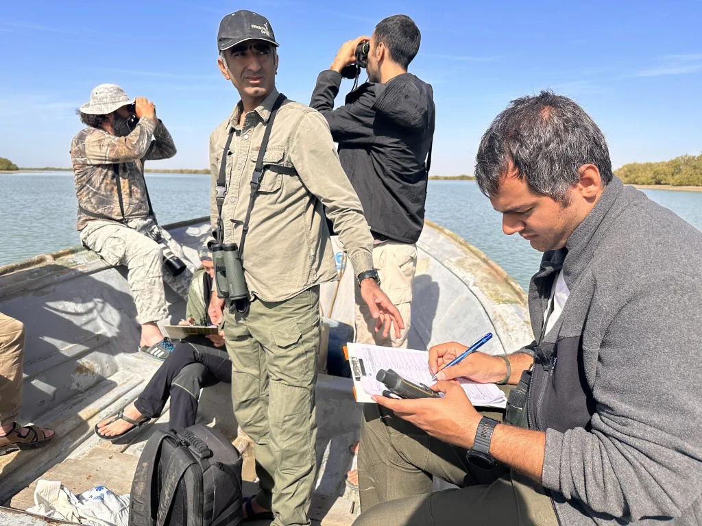
Hormozgan contains an extensive network of coastal wetlands, mudflats, islands and intertidal habitats along the Persian Gulf and Gulf of Oman. I have worked on the province’s waterbird census programme through field surveys, project coordination and the development of local monitoring capacity.
The documented 2023 census covered 32 wetlands and recorded 64,123 birds from 97 species. The programme has also involved volunteers and field capacity building, with the aim of strengthening the local system needed to repeat large-scale waterbird monitoring across the province.
Fars Waterbird Census
Fars Province · 2022–2023 · Project Manager / Field Expert
The Fars waterbird census was designed to provide a province-wide assessment of waterbirds across a diverse network of wetlands. We surveyed 13 sites covering approximately 179,340 hectares, with an average survey coverage of about 85% of each site.
The census recorded 20,027 waterbirds representing 76 species. The work was carried out with the Department of Environment of Fars Province and produced a technical baseline that could be used to compare sites, identify changes and support future wetland management and monitoring.
Isfahan Waterbird Census
Isfahan Province · 2017–2020 · Project Manager
From 2017 to 2020, I managed the waterbird census programme across 17 sites in Isfahan Province in collaboration with the Department of Environment. The work involved repeated field surveys across wetlands with very different ecological conditions and levels of degradation.
The aim was to produce consistent field information on waterbird presence and abundance that could be used by the provincial conservation authority. The surveys were translated into technical reports rather than academic outputs, and the data remained with the commissioning authority.
This programme became an important part of my longer-term involvement in wetland monitoring. It also shaped much of my later work, where bird counts are treated as information for conservation management rather than as isolated annual records.
Taleghan Bird Survey
Taleghan, Iran · 2017–2018 · Project Manager
The Taleghan Bird Survey was a one-year field study focused on identifying the bird species using the protected and no-hunting areas of Taleghan. I managed the project from field planning and implementation through to the final reporting.
Surveys were carried out across the year to document bird diversity, distribution and seasonality, while also recording relevant conservation threats. Working across seasons was important because it allowed us to build a picture of the area’s bird community that included resident, breeding and migratory species rather than relying on a single survey period.
The project also considered the potential for birdwatching and conservation-compatible local livelihoods in the area. The final dataset and technical report were prepared for the commissioning organisation.
Policy, Governance & Conservation Systems
National Bird Guidelines
Iran · 2025–present · Project Manager / Joint Focal Point
In 2025, AvayeBoom and Iran’s Department of Environment began a national programme to develop three technical guidelines covering birdwatching in protected areas, filming birds with drones, and the release of rehabilitated birds. I was selected as the focal person responsible for managing the work across both organisations.
The guidelines combine international standards, scientific literature, practical experience from AvayeBoom and the Department of Environment, and stakeholder review. By September 2026, the rehabilitated-bird release guideline had been formally issued, the drone guideline was close to formal issuance, and the birdwatching guideline remained in the institutional process.
Updating Iran’s Waterbird Hunting Regulation
Iran · 2025 · Project Lead / NGO Technical Lead
Iran’s national waterbird hunting regulation had remained largely unchanged for decades and no longer reflected current ecological knowledge, the conservation status of many species, or the realities of wetland management. In 2025, I led AvayeBoom’s technical contribution to a national process to revise it.
We obtained the existing regulation, reviewed it article by article, and circulated it among relevant experts, hunting organisations and conservation groups. Their comments were combined with our own technical review and submitted to the Department of Environment as a consolidated set of proposed changes.
The Department reviewed and accepted the proposed revisions, and the updated regulation was formally adopted in 2025. The revised framework strengthened the ecological basis of hunting management, improved protection for threatened species and brought a broader range of stakeholders into the regulatory process.
Reforming Songbird / Passerine Trapping Permits
Iran · 2026 · Policy Lead / Principal NGO Representative
The project addressed the permitting system for the capture of passerines and other songbirds in Iran. We documented conservation and policy concerns, reviewed the available evidence, prepared a policy brief and took the issue through formal correspondence and direct discussions with the Department of Environment.
Following this process and the wider governmental decision-making that followed, the Department of Environment suspended the issuance of passerine capture permits for five years. The work was an example of using technical evidence, formal institutional engagement and sustained advocacy to move a specific conservation concern into national policy.
Homa Environmental Grant
Iran · 2025–present · Director
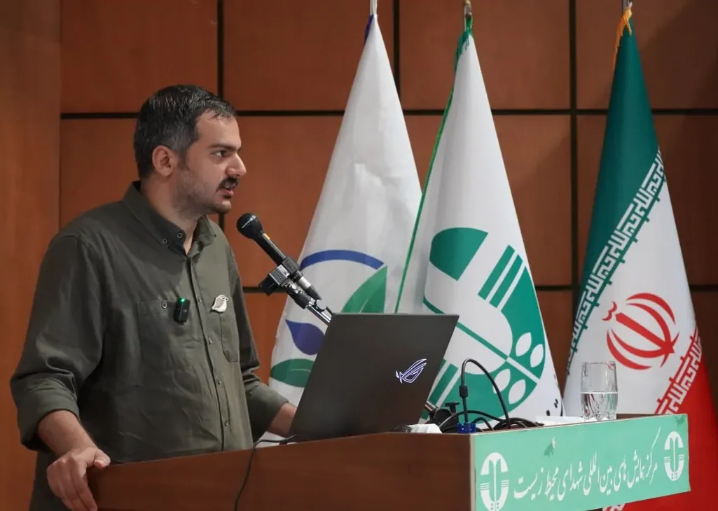
I founded the Homa Environmental Grant to support conservation teams working on practical environmental problems across Iran. My role includes designing the programme, developing calls, reviewing proposals, coordinating expert assessment, selecting grants, allocating resources and mentoring funded teams through implementation.
The first cycle received 56 proposals, from which six projects were shortlisted and three principal grants were selected. Homa represents an important shift in my own work: from leading conservation projects directly towards also building systems that can finance, guide and strengthen the work of other conservationists and organisations.
Shidvar Island Breeding Bird Conservation
Shidvar Island, Persian Gulf · 2020–2023 · Project Lead
The island
Shidvar is a small uninhabited island in the Persian Gulf and an important breeding site for several seabird species. I led conservation and monitoring work on the island from 2020 to 2023, in collaboration with the Department of Environment of Hormozgan Province and local partners.
The dominant breeding birds included Bridled Tern, White-cheeked Tern, Lesser Crested Tern, Greater Crested Tern and Cattle Egret. During the breeding season, large parts of the island were occupied by nests, eggs and chicks, making even routine movement across the site a conservation issue in itself.
The programme combined breeding-bird monitoring, field research, management planning and direct conservation intervention. One of the clearest threats we identified was the presence of feral cats in a breeding system where ground-nesting seabirds had little protection from an introduced terrestrial predator.
Fieldwork and monitoring
Monitoring Shidvar was technically demanding because field teams had to work inside a dense breeding colony without creating a new source of disturbance. An important part of leading the project was therefore training experts and volunteers and developing a field system for movement, observation and data collection that reduced the risk of stepping on nests, disturbing incubating birds or separating chicks from breeding areas.
Across the project, I worked with two AvayeBoom experts and seven AvayeBoom volunteers, alongside three experts from the Department of Environment of Hormozgan Province. Maintaining consistency between different field teams was particularly important because the monitoring extended across several breeding seasons.
Shidvar is also close to Lavan Island, a major oil and industrial island in the Persian Gulf. Alongside breeding-bird monitoring and predator management, we paid attention to potential pressures associated with this neighbouring industrial landscape and tried to document changes that could help us understand its influence on the island over time.
Feral cat removal
Fourteen feral cats were removed from the island in 2021. Continued monitoring showed that three remained, and these were removed in 2022, bringing the total to 17.
The removal was carried out alongside continued monitoring of the breeding colony. This allowed us to move beyond removing the threat itself and examine whether a measurable response could be detected in the birds after the intervention.
What changed
Monitoring of White-cheeked Terns showed a substantial shift in clutch-size distribution following cat removal. Larger clutches became more frequent after the intervention, providing measurable evidence of change in the breeding population. The results were later published in Conservation Evidence Journal, linking the management intervention directly with the monitoring data collected on the island.
Research output
Ebrahimi, I., Ranjbaran, A., Ghasemi, M., Kazemi, F., Eskandari, F., & Goudarzi, F. (2026). Rapid Shift in Clutch Size Distribution of White-cheeked Terns Sterna repressa Following Feral Cat Removal on Shidvar Island, Persian Gulf. Conservation Evidence Journal, 23, 20–25.
Partners
AvayeBoom Bird Conservation Society
Province Lavan Free Zone Organisation
Department of Environment of Hormozgan
Asian Houbara Power-line Collision Mitigation
Abbas Abad Wildlife Refuge, Isfahan Province · 2019–2020 · Project Manager / Research Lead
Abbas Abad Wildlife Refuge
Abbas Abad Wildlife Refuge covers more than 3,000 km² of the central Iranian plateau. Its landscape includes a long central mountain range surrounded by desert hills and plateaus, with elevations ranging from roughly 620 to 2,400 metres. The area supports Asian Houbara, also known as MacQueen’s Bustard, alongside a wider community of desert and steppe wildlife.
The refuge is crossed by electricity infrastructure serving settlements and agricultural areas around the protected landscape. For large, heavy-bodied birds such as bustards, these lines can become a serious source of mortality, particularly where feeding areas and regular flight paths intersect with the wires.
Understanding the problem
The project began with a simple management question: where were the birds actually colliding with the lines, and could we intervene in those specific places rather than treating the entire network?
We selected a 21 km section of power line for systematic monitoring. Around eight kilometres of this route ran beside barley fields used by Houbara as feeding habitat. Collision records quickly showed that mortality was not distributed evenly along the line. Seven of the nine collisions recorded during the baseline period occurred around this agricultural section.
Some records came directly from ranger monitoring, while others were reported by people working in the landscape and then checked in the field. This combination of systematic monitoring and local reporting gave us a stronger picture of where collisions were occurring than either source could have provided alone.
Identifying the hotspot
Rather than choosing the intervention site by visual judgement alone, we mapped the collision records and used Kernel Density Estimation to identify the section where incidents were concentrated.
The analysis indicated a core hotspot of approximately 4.5 km. Because the available budget allowed us to work across a longer section, we extended the treatment beyond the core hotspot and covered seven kilometres of the line, providing additional protection on both sides of the highest-risk area.
This was important to the design of the project. The intervention followed the evidence from the baseline monitoring rather than beginning with a predetermined section of infrastructure.
Installing the diverters
We installed 450 spiral bird diverters along the seven-kilometre high-risk section. The spirals were highly visible, UV-resistant and produced in yellow and orange to increase the visibility of the wires to approaching birds.
Six diverters were installed between consecutive electricity poles, with the poles spaced at approximately 40 metres along the treated section.
Implementation required cooperation well beyond the conservation team. The electricity distribution company controlled the infrastructure and funded the intervention, while the Department of Environment contributed field knowledge and conservation expertise. Bringing these organisations together was one of the essential parts of getting the intervention from a research idea onto an operational electricity network.
Building the monitoring system
Installing diverters would tell us little without continuing the monitoring afterwards. We therefore used a before-and-after design, with approximately one year of monitoring before installation and another year after the intervention.
Rangers involved in the project received training in identifying evidence of bird collisions and recording incidents consistently. The power line was checked regularly, approximately every two weeks, and reports received from farmers or other people using the area were followed up in the field.
I led the project and research team, developed the intervention and study design, coordinated monitoring and implementation, contributed directly to field data collection and interpretation, and later led the preparation of the research for publication.
What changed
During the baseline monitoring period, nine Asian Houbara collisions were recorded along the monitored power line.
During the year following installation of the 450 diverters, no collisions were recorded in the treated section.
For me, that before-and-after result was the most important part of the project. We had moved through the full conservation chain: identifying a specific threat, locating where it was concentrated, designing an intervention around that evidence, implementing it with the institution responsible for the infrastructure, and then returning to the field to measure what happened.
The result was encouraging, but it also needs to be understood within the limits of the study. Monitoring covered one year after installation, and collision risk can also be influenced by changes in rainfall, vegetation, agricultural use, weather and bird movement. Longer-term monitoring would provide stronger evidence about how durable the effect is and how well the same approach transfers to other landscapes.
Working across institutions
This project depended on cooperation between conservation and infrastructure institutions that normally work with very different priorities.
The Department of Environment of Isfahan Province provided conservation and field support. The Esfahan Province Electricity Distribution Company funded the project and enabled modifications to the electricity infrastructure.
For me, this was an important part of the project beyond the technical result. Wildlife mortality caused by infrastructure often cannot be solved by conservation organisations alone. The institution managing the infrastructure has to become part of the conservation response.
Research output
Ebrahimi, I., Kazemi, F., & Agha Ebrahimi, M. A. (2024). Effectiveness of Spiral Diverters in Preventing Asian Houbara Power Line Collisions in Abbas Abad Wildlife Refuge, Iran. ECOPERSIA, 12(4), 405–412.
Partners
AvayeBoom Bird Conservation Society
Department of Environment of Isfahan Province
Esfahan Province Electricity Distribution Company
The project was funded by the Esfahan Province Electricity Distribution Company.
Arjan Wetland Flagship Species & Community Conservation Programme
Arjan International Wetland, Fars Province · 2020–present · Project Lead / Lead Researcher
Arjan
Arjan International Wetland is a seasonal freshwater wetland in Fars Province, around 60 km southwest of Shiraz. During wet periods it can cover roughly 2,200 hectares. It has been a Ramsar site since 1975 and forms part of the Arjan–Parishan Protected Area and Biosphere Reserve.
Dasht-e Arjan village sits beside the wetland, with around 2,300 residents whose livelihoods include agriculture, livestock, local commerce and transport. Water reaching the wetland also passes through this human landscape. This makes Arjan a place where ecological conservation cannot be separated from the choices, livelihoods and relationships of the people living around it.
The wider landscape supports more than 260 recorded bird species, including more than 70 waterbird species associated with the wetland. At the same time, Arjan has faced long-term pressure from water extraction, wells, agricultural expansion, poaching, roads, power lines, disturbance and repeated periods of severe drying.
How the project began
I first came to Arjan in 2020 after being invited by the local Department of Environment office to advise on bird conservation. The ecological problems were visible, but what interested me most was the relationship between the wetland and the people living beside it.
People had not lost their history with Arjan. The wetland remained part of local memory and identity. But the everyday relationship with its wildlife had weakened. One of the questions that gradually shaped the project was whether conservation could rebuild part of that relationship, using a living species that people could recognise and encounter around them.
The history of the Persian lion was important in this thinking. The lion once lived in Arjan and remained a powerful symbol of the landscape long after its disappearance. But it belonged to the past. We wanted to know whether a species that was still present could become a living point of connection between the community and the wetland.
Choosing a flagship with the community
We considered three waterbirds as possible local flagship species: Ruddy Shelduck, Common Crane and Eurasian Coot.
I developed a ten-criteria selection framework that combined ecological considerations with recognition, local ecological knowledge, positive associations, cultural meaning, charisma and other social factors. The aim was to avoid selecting a species only because conservation professionals considered it attractive or important.
In April 2022, local participants gathered in the community hall of the village mosque. Sixty-five people were included in the assessment. Their knowledge and attitudes were combined with ecological and conservation information for the three candidate species.
The Ruddy Shelduck, Tadorna ferruginea, received the highest overall score and was selected as the flagship species of Arjan International Wetland.
Locally, people commonly referred to it as the red goose. It was already recognisable, visually distinctive and connected to memories of the wetland. Some villagers told us that they had not seen the “red goose with white wings” for years, even though our field observations showed that the species was still using Arjan. That difference between ecological presence and social visibility became important to the project.
From a species to a local symbol
Selection was only the beginning. From 2022 onwards, we worked to bring the species into ordinary social spaces rather than limiting it to conservation workshops.
A local Ruddy Shelduck logo was developed. The entrance sign of Dasht-e Arjan village was redesigned to include the bird. Murals were created with children and community members. Stickers appeared on local vehicles. Educational materials and symbolic items such as badges and reusable bags were distributed.
We also organised village workshops, school activities, reading programmes, drawing activities and guided birdwatching experiences for local children. The purpose was repeated contact, not a single awareness event. The bird gradually appeared in different parts of village life and became easier to recognise, name and connect with the wetland.
For me, this was an important distinction. We were not trying to create a brand around a bird. We were trying to strengthen a relationship that already had cultural and ecological roots.
Measuring social change
In 2026, we returned to the village to examine what had changed four years after the flagship selection.
We conducted a new household survey with 65 participants, using variables that could be compared with the 2022 baseline. We also conducted 15 semi-structured interviews to understand the meanings behind the quantitative changes.
Correct identification of the Ruddy Shelduck increased from 45.0% in 2022 to 92.3% in 2026. Positive attitudes toward the species increased from 35.0% to 92.3%.
By 2026, respondents also strongly associated the species with the place itself. Agreement that the Ruddy Shelduck had become a symbol of Arjan averaged 4.22 out of 5, while agreement that the bird belonged to the people of Arjan averaged 4.32 out of 5.
The interviews showed something that mattered even more to me. People were using the bird in narratives about Arjan, local pride, memory and concern for the future of the wetland. The species had moved beyond recognition and entered the way some residents talked about their place.
Participation and conservation
Forty-three percent of respondents in the 2026 survey reported having participated in conservation-related activities, and 86.2% expressed high willingness to participate in future conservation work.
Local participation also became more practical over time. Residents, volunteers, local organisations and conservation staff became involved in monitoring, educational activities and discussions about the management of the wetland.
This does not mean that a flagship species automatically changes behaviour. Our evaluation also found that translation from positive attitudes into sustained conservation behaviour remained uneven. Water, land use, institutional capacity and economic realities continue to shape what people can actually do.
That distinction is important to how I understand the project. Social connection creates conservation capacity, but it does not remove structural problems.
Monitoring the birds
Alongside the social work, we established a standardised annual count of Ruddy Shelducks during the peak wintering period.
Counts were conducted in January using fixed vantage points and systematic patrols to achieve near-complete coverage of the wetland. The same field approach, equipment and core observers were maintained as consistently as possible between years.
The annual count increased from 312 Ruddy Shelducks in 2023 to 1,326 in 2026.
I do not treat this increase as evidence that the flagship programme caused the population change. Arjan is a highly variable seasonal wetland. Rainfall, water availability, habitat conditions, disturbance and regional bird movements all affect annual numbers.
The ecological trend is therefore useful as monitoring evidence, but it should remain separate from causal claims about the social intervention.
From symbolism to direct conservation
As our understanding of the species improved, the project began moving from social engagement towards more direct conservation of Ruddy Shelducks and their breeding cycle.
We found that birds nest in rocky areas above the wetland and that newly hatched chicks must cross exposed ground to reach water. Field observations, local knowledge and later mapping helped identify several routes used by adults and chicks.
These routes can expose chicks to disturbance, livestock and dogs. The next stage of the programme has therefore focused on making these movements safer, including identifying priority corridors, working with herders and local residents, improving vegetation cover where appropriate, and building a local guardianship system around sensitive periods.
This is an important evolution of the project for me. The flagship began as a way to rebuild social connection with the wetland, but that relationship is now creating opportunities for very concrete species-level conservation.
What the project has taught me
Arjan has become one of the places that most strongly shaped how I think about conservation.
The first lesson is that awareness and relationship are different things. People can know that a wetland exists and still have little everyday relationship with it. Repeated encounters, local symbols, participation and shared experiences can gradually give a species and a place a different position in social life.
The second lesson is that relationship alone is insufficient. Arjan still needs water, habitat protection, functioning institutions, enforcement and practical management. A community may care deeply about a wetland while remaining unable to solve problems created far beyond the village.
For me, the most useful conservation question is therefore not whether social work or ecological intervention matters more. It is how the two can reinforce each other over enough time to become durable.
Research outputs
Ebrahimi, I., Dai, R., Kazemi, F., & Seifii, A. (2024).
Selecting a flagship species for Arjan International Wetland in Iran.
Journal of Wildlife and Biodiversity, 8(4), 364–383.
A second study evaluating the social and ecological outcomes of the programme from 2022 to 2026 is currently under review.
Partners
Department of Environment of Fars Province
Parishan Heritage Association
Kazeroun Environmental House
Avaye Zist Boom Arjan Association
UNDP / Small Grants Programme
Divar
The programme has developed through different phases, with different local and institutional partners supporting research, field implementation, community activities and conservation work.
Bee-eater–Beekeeper Conflict Mitigation
Iran · 2021–2023 · Project Lead / Research Lead
The conflict
Bee-eaters and beekeepers share the same landscape at exactly the wrong time. During parts of spring, summer and migration periods, bee-eaters can gather around apiaries and feed on honeybees. For beekeepers whose income depends on keeping strong colonies, the birds can become a serious source of frustration and perceived economic loss.
In Iran, this conflict had also produced damaging responses. Some beekeepers used shooting or poisoned bees to kill bee-eaters around their apiaries. Poisoning was particularly concerning because its effects did not necessarily end with the target birds. Contaminated carcasses could remain available to scavengers and other wildlife, extending the environmental cost of an attempt to solve a local problem.
I was interested in a different question: whether we could reduce the conflict by working directly with beekeepers, taking their losses seriously, and giving them practical alternatives that did not depend on killing the birds.
Designing the project
The project began in 2021 as a pilot focused on practical coexistence.
Before going into the field, we reviewed available research and management experience to identify methods that could realistically be used under Iranian conditions. Approaches that were too expensive, difficult to obtain, unsuitable for local conditions or likely to create other environmental problems were excluded.
The useful material was then translated into an illustrated educational catalogue. It covered bee-eater ecology, the ecological consequences of lethal control, apiary management and different non-lethal approaches that could be considered depending on the conditions of each site.
But I did not want the project to work as a one-way transfer of information. Beekeepers already had years of experience dealing with these birds. Their own observations, methods and understanding of when and where damage occurred were part of the information we needed.
Working in the field
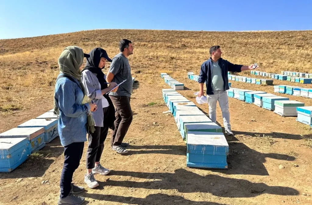
We worked with 78 beekeepers across four high-conflict areas: Kazerun, Dalan Kuh, Fereydunshahr and Sibak, spanning parts of Fars and Isfahan provinces.
The apiaries varied enormously in scale. Some participants managed relatively small operations, while others had hundreds of hives. That mattered because there was never going to be one intervention that made sense everywhere.
Each beekeeper received the educational material, followed by a face-to-face discussion that usually lasted between 20 and 60 minutes. These conversations covered the ecology of bee-eaters, how the conflict was being managed at that particular apiary, and which alternative measures were realistic for that beekeeper.
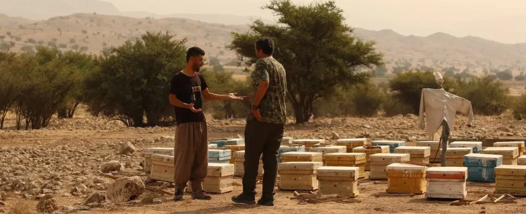
The field discussions also worked in the opposite direction. We asked beekeepers what they were already doing, what they believed worked, what had failed, how they perceived the birds, and what conditions made the conflict worse. Their answers became part of the project dataset.
More than awareness
A major part of the problem was practical rather than informational. It was easy to tell somebody that bee-eaters had ecological value. That information alone did not answer the beekeeper standing beside a hive and watching birds take bees.
So the intervention had to connect ecological information with a management decision.
The catalogue and field conversations presented non-lethal deterrence and apiary-management options and encouraged beekeepers to select approaches that were realistic under their own conditions. We also discussed the environmental consequences of poisoning and shooting and why replacing one ecological problem with another was a poor long-term solution.
This was one of the projects where my background in psychology became especially useful in field conservation. The task was not simply to communicate facts about birds. It was to understand the behaviour we wanted to change, the practical reasons behind it, and what would make an alternative behaviour possible.
Following up one year later
The project became more useful when we returned to the participants rather than stopping after the training.
Approximately one year after the intervention, we were able to follow up with 57 of the original 78 beekeepers. We asked about their use of the educational material, whether they had tried the suggested approaches, and how they felt the bee-eater conflict had changed.
The material itself travelled beyond the original conversations. Of the 57 beekeepers reached at follow-up, 54 reported that they had studied the catalogue and 51 said they had shared it with others.
Among the 54 participants who answered the relevant question about method use, 39, or 72.2%, reported using at least one of the suggested approaches.
That mattered to me because it represented behaviour beyond simply receiving or remembering information.
What they reported
Among the 57 beekeepers reached at the one-year follow-up:
42 people, or 73.7%, reported that the conflict had decreased.
Nine, or 15.8%, reported no change.
Six, or 10.5%, reported that the conflict had increased.
The pattern also varied geographically. All 15 followed-up participants from Fereydunshahr reported a decrease, while outcomes in Kazerun were more mixed. That variation was a useful reminder that human–wildlife conflict is shaped by local ecological and management conditions and cannot be reduced to one intervention working identically everywhere.
What the results can tell us
I treat these results carefully.
There was no untreated control group, and the outcomes were reported by beekeepers themselves rather than measured independently at their apiaries. We therefore cannot say that the educational intervention caused the reported reductions in conflict.
Other factors could have changed between years, including bee-eater abundance, weather, apiary location, migration patterns, food availability and hive management.
What we can say is more specific: one year after a field-based intervention, most of the beekeepers we were able to contact reported lower conflict, and a substantial majority of those answering the method-use question reported trying at least one of the suggested measures.
For an applied conservation project, that was enough to justify taking the approach seriously and studying it more rigorously.
What the project changed for me
This project helped shape how I later approached human dimensions of conservation.
People involved in wildlife conflict usually have a reason for their behaviour. In this case, killing bee-eaters could not be understood only as a lack of environmental awareness. There was a livelihood problem behind it, a history of attempted solutions, local knowledge, frustration, and a need for alternatives that were practical rather than idealised.
That changed the conservation question. Instead of asking only how to persuade beekeepers to stop harming birds, the work became about how to make coexistence a workable choice.
The same principle has remained central to much of my later work: behaviour becomes easier to change when conservation engages with the problem as people actually experience it.
Research output
A manuscript reporting the one-year follow-up has been submitted to Conservation Evidence Journal:
Reported change in beekeeper–bee-eater conflict one year after a field-based educational intervention in Iran.
A second study evaluating the social and ecological outcomes of the programme from 2022 to 2026 is currently under review.
Partners
AvayeBoom Bird Conservation Society
Department of Environment of Isfahan Province
Department of Environment of Fars Province
Parishan Heritage Association
Main funder: Nazre Tabiat NGO
Gavkhouni Wetland Biodiversity Platform
Gavkhouni International Wetland, Isfahan Province · 2021–2023 development · launched 2024 · Project Manager
Gavkhouni
Gavkhouni is the terminal wetland of the Zayandeh Rud basin in central Iran. It is one of Iran’s long-established Ramsar sites, designated in 1975, and includes the saline lake and the lower marshes of the Zayandeh Rud.
The wetland sits in a desert landscape east of Isfahan and has long been important for migratory waterbirds. Its ecological condition is closely tied to the flow of the Zayandeh Rud, seasonal rainfall and the wider management of water across the basin.
By the time this project began, Gavkhouni had already become widely known through the language of drought, water scarcity and ecological decline. But the information about the wetland itself was scattered across scientific papers, government reports, local memory, photographs, personal archives and the knowledge of people living around it.
That fragmentation became the starting point of the project.
The idea
I wanted to build a place where different kinds of knowledge about Gavkhouni could exist together.
Scientific information was important, but it represented only one part of the wetland. Local residents held memories and stories. Rangers had long-term field knowledge. Tour guides had photographs and observations. Researchers had papers and datasets. Children produced drawings. Government organisations held technical information that rarely reached the public.
The project was therefore designed around CEPA: Communication, Education, Participation and Awareness, one of the central frameworks used in wetland conservation.
The aim was to create a public biodiversity and cultural-information platform that people could use, contribute to and eventually help manage themselves.
Building the platform
Developing the platform required much more than building a website.
We first worked on organising existing information about the wetland and making it accessible to a wider audience. This included biodiversity records, species information, scientific publications, books, photographs and other documentation related to Gavkhouni.
An updated animal checklist was developed as part of the work. Information was organised across different groups of wildlife rather than treating the wetland only as a bird site.
At the same time, we deliberately created space for forms of knowledge that are rarely included in conventional biodiversity databases: local stories, memories, children’s paintings, photographs and perspectives from people who had lived or worked around the wetland.
For me, that was one of the most important parts of the project. Gavkhouni existed both as an ecosystem and as a landscape remembered, used and interpreted by people. The platform needed to reflect both.
Bringing stakeholders into one space
The project involved a broad group of stakeholders, including local residents, NGOs, rangers, local tour guides, conservation experts, the Municipality of Varzaneh, the Department of Environment of Isfahan Province and the national Department of Environment.
Each group related to Gavkhouni differently.
Some contributed technical information. Others contributed photographs, stories or field observations. Local organisations helped connect the project with residents and the surrounding community. Government institutions contributed their own records and institutional knowledge.
My role was to manage these different contributions and keep the project moving towards a shared platform rather than a website owned conceptually by a single organisation.
A wetland people could enter virtually
One part of the platform that I particularly valued was the virtual wetland tour.
We created 360-degree imagery from 18 locations across Gavkhouni, including places that are difficult for most visitors to reach. The aim was to allow people to experience the scale and character of the landscape even if they could not physically travel through it.
This was especially useful for a wetland where access, distance and environmental conditions can make direct visitation difficult.
The virtual tour also changed the function of the website. It became more than an information archive. It gave people a way to move through the landscape visually and connect scientific or cultural information with an actual sense of place.
Persian first, but not only Persian
The primary audience was Iranian, so the main platform was developed in Persian.
We also created English-language sections so that researchers, conservation organisations and other international users could access key information about the wetland.
That mattered because Gavkhouni is a Ramsar site of international importance, while much of the available information about it had remained difficult to access outside Persian-language sources.
Transferring ownership
From the beginning, I did not want the long-term future of the platform to depend entirely on AvayeBoom.
From 2022 onwards, responsibility for the platform was increasingly transferred to local stakeholders. The intention was for people and organisations connected directly to Gavkhouni to become active contributors and managers of the resource.
This was probably the most important governance element of the project.
Building a technically good website would have been relatively easy. Building something that could continue to receive knowledge, stories, photographs and updates after the original project team stepped back was much harder.
By the end of the main project period, AvayeBoom had moved into a supporting role rather than remaining the sole manager.
Public launch
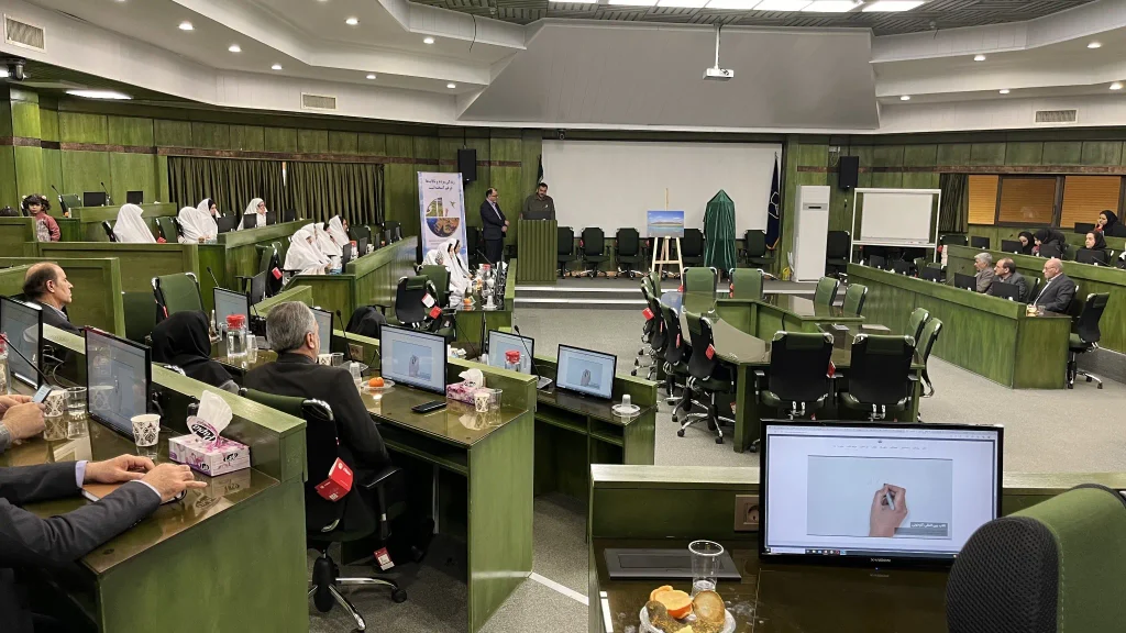
The platform was publicly introduced during World Wetlands Day 2024 in Varzaneh, with participation from local managers, university students, NGOs and members of the local community.
By that point, the platform brought together biodiversity information, scientific resources, cultural material and the virtual wetland experience in one public place.
For me, the launch was less important than what came after it. The real value of the platform depended on whether Gavkhouni’s information could remain accessible and whether the people connected to the wetland continued to see it as something they could contribute to.
What I took from the project
Gavkhouni reinforced something that has become increasingly important in my work: conservation information has value only when people can reach it, understand it and feel some ownership over it.
A scientific paper, a ranger’s memory, a child’s drawing and a local photograph are very different kinds of evidence. They should not be treated as equivalent. But they can still sit beside each other and help build a fuller picture of a place.
The project also changed how I thought about exit strategies. A conservation project can be successful partly because the organisation that created it becomes less central over time.
For Gavkhouni, transferring management and contribution gradually towards local stakeholders was therefore part of the project itself, not something added after the platform was finished.
Project output
Gavkhouni International Wetland Biodiversity Platform
Partners
AvayeBoom Bird Conservation Society
Municipality of Varzaneh
Department of Environment of Isfahan Province
Iran Department of Environment
Local residents and community organisations
Local tour guides
Mazandaran Waterbird Census
Mazandaran Province · 2026 · Project Manager
The southern Caspian landscape
Mazandaran lies along the southern coast of the Caspian Sea and contains one of Iran’s most important concentrations of wintering and migratory waterbird habitat. The province is not a single wetland system. It is a mosaic of large natural wetlands, coastal habitats, river mouths, traditional Ab-bandans, managed water bodies and Damgahs.
At the eastern end of this landscape lies Miankaleh, one of Iran’s best-known Ramsar sites and a major wintering and passage area for waterbirds. Further west, smaller wetlands and traditional water-management systems create a much more fragmented network of habitats distributed across an intensively used human landscape.
That diversity makes a provincial census difficult, but also useful. Counting birds across Mazandaran means working across very different ecological conditions, management systems, levels of access and degrees of human disturbance.
Building the census
In January 2026, I managed AvayeBoom’s scientific and field participation in a collaborative province-wide census with the Mazandaran Provincial Department of Environment.
The project followed the framework of the International Waterbird Census, with the aim of producing a broad picture of wintering waterbird abundance, species diversity and distribution across the province.
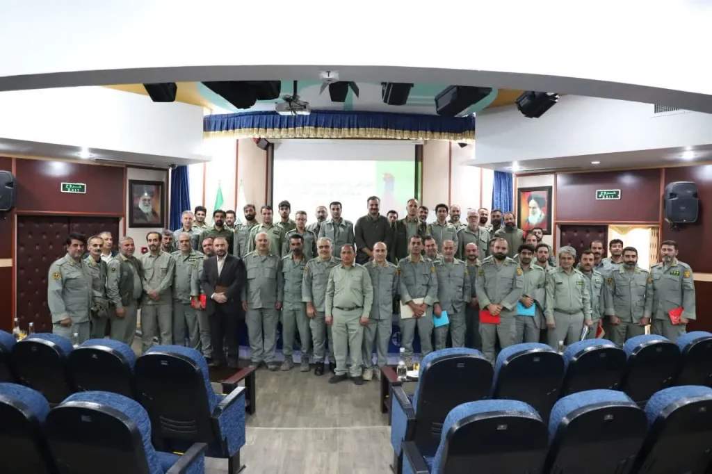
Before fieldwork began, we issued a public call for people interested in participating. Selected volunteers, environmental activists and Department of Environment personnel received training in waterbird census methods.
The training included both a theoretical component and practical field instruction. This mattered because one of the goals of the project was to leave behind stronger local monitoring capacity, not only a dataset from one winter.
Ten days across 36 sites
The field census was carried out over 10 days across 36 sites.
The sites included major wetlands, traditional Ab-bandans, Damgahs, other water bodies and long stretches of the Caspian coastline. Some could be surveyed relatively completely from established observation points. Others were much more difficult because of their size, vegetation, fragmented boundaries, access restrictions or the movement of birds between neighbouring areas.
Working at this scale required constant coordination between AvayeBoom field experts, volunteers, local collaborators, rangers and staff from different Department of Environment offices across the province.
The published project report acknowledges 24 named field experts and volunteer contributors, in addition to Department of Environment staff who supported field access, logistics, local knowledge and data collection.
What we recorded
Across the 36 surveyed sites, we recorded 54,889 birds representing 112 species.
Waterbirds made up the overwhelming majority of the count, with more than 54,000 individuals recorded across the province. Raptors and other bird species closely associated with wetland habitats were also documented during the surveys.
The value of the census was in the distribution behind that total.
Bird numbers were highly uneven between sites. A substantial proportion of the observed population was concentrated in a relatively small number of areas, particularly major secure wetlands and parts of the traditional Damgah network.
Other sites that appeared physically capable of supporting waterbirds held surprisingly few birds.
Birds were responding to people as well as habitat
One of the clearest patterns from the census was that habitat alone could not explain where birds were concentrated.
Human access, disturbance and the level of security available at a site appeared repeatedly alongside ecological conditions as important factors shaping bird distribution.
Some relatively secure sites with restricted access supported dense concentrations of birds. Elsewhere, apparently suitable habitats held much smaller numbers where disturbance, land-use change or habitat degradation were more prominent.
For me, this was one of the most useful outcomes of the project. A census becomes much more valuable when it helps explain why birds are distributed as they are, rather than simply producing a provincial total.
Ab-bandans and Damgahs
Mazandaran also demonstrates why wetland monitoring has to understand the human systems surrounding a site.
Traditional Ab-bandans are shallow managed water bodies embedded in agricultural landscapes. They can provide important habitat for waterbirds while also serving local economic and water-management functions.
The Damgah landscape presents an even more complicated relationship. These traditional waterfowl trapping areas are central to the hunting system of the region, but their management, restricted access and habitat characteristics can also influence where large concentrations of birds remain during winter.
The census therefore crossed landscapes that cannot be understood through a simple division between “natural habitat” and “human use”. Waterbirds in Mazandaran move through systems shaped simultaneously by ecology, agriculture, hunting, local management and conservation.
This observation has also influenced my later work in Fereydunkenar and Sarakhrud.
Improving future monitoring
The fieldwork also revealed methodological problems that matter when annual census numbers are compared.
Some sites had unclear or changing boundaries. Survey coverage differed substantially depending on access and visibility. In large coastal areas, only part of the full habitat could be surveyed directly. At some sites, changes in vegetation or human activity affected how easily birds could be detected.
One of our recommendations was therefore to strengthen future repeatability through clearly defined site and sub-site boundaries, fixed polygons, standardised count points and better documentation of survey coverage.
These details may sound technical, but they determine whether a change between two annual counts represents a real ecological change or simply a difference in where and how people counted.
From counting birds to managing wetlands
Waterbird censuses are often presented as annual exercises: a team goes into the field, counts birds, submits a number and repeats the process the following year.
I see their value differently.
A strong census can identify concentration areas, changes in habitat use, sites where disturbance may be suppressing bird numbers, weaknesses in monitoring design and places where management attention should be prioritised.
That was the direction I wanted this project to take in Mazandaran. The 2026 census produced a provincial dataset, but it also created a basis for improving how future counts are conducted and how their results can be used in wetland management.
The combination of field monitoring, local training and institutional cooperation was therefore as important to me as the final number of birds recorded.
Technical output
Ebrahimi, I., & Kazemi, F. (2026).
Report on the 2025 Waterbirds Census Project in Mazandaran Province, Iran.
AvayeBoom Bird Conservation Society & Mazandaran Provincial Department of Environment.
Hormozgan Waterbird Census
Hormozgan Province · 2021–present · Project Manager / Field Expert
A coastline between two seas
Hormozgan stretches along the Persian Gulf, the Strait of Hormuz and the Gulf of Oman. Its waterbird habitats include intertidal mudflats, mangrove forests, estuaries, creeks, islands, sheltered bays and long open coastlines.
This makes the province exceptionally important for migratory shorebirds and other waterbirds, but also unusually difficult to monitor. Some sites can be reached by road. Others require boats. At many coastal sites, the area that can be counted depends on tides, wind, sea conditions and access on that particular day.
The province also includes major mangrove systems such as Khoor-e Khooran, where extensive Avicennia marina forests, tidal creeks and mudflats provide feeding and roosting habitat for large numbers of migratory birds. Taylor & Francis Online
Building a provincial monitoring programme
I began working on Hormozgan’s waterbird census programme in 2021, initially as both project manager and field expert, in collaboration with the Department of Environment of Hormozgan Province.
The aim was larger than completing an annual bird count. We wanted to improve the consistency of monitoring across a province where sites are widely dispersed and where long-term census capacity depends heavily on having trained people who can work independently in difficult coastal conditions.
The programme therefore combined field census work with volunteer participation, knowledge transfer and the gradual development of local monitoring capacity.
Fieldwork across Hormozgan
The 2023 census covered more than 30 wetlands and coastal sites, from Khoor-e Khooran in the west towards the eastern coast of the province.
Fieldwork extended over approximately 20 days, from late January into February. Coastal work was strongly affected by weather. At one point, strong winds interrupted sea travel for more than a week, forcing the team to stop boat-based surveys and reorganise the field schedule. ResearchGate
This kind of disruption is normal in large coastal monitoring programmes. A census plan may look fixed on paper, but in the field it has to respond to tides, wind, boats, access, visibility and the movement of birds between neighbouring areas.
The team
The 2023 programme involved eight field experts, including me, together with seven collaborating volunteers.
The work also depended on support from local Department of Environment offices, municipalities and communities across the province. Boats, accommodation, fuel, local access and knowledge of individual creeks often came through people and institutions based close to the census sites.
Over the first two years of the programme, at least ten volunteers worked alongside project experts in the field. Developing their skills was one of the explicit objectives of the programme, because a province of this scale cannot depend permanently on a small visiting expert team. ResearchGate
What we recorded
In 2023, the census recorded 64,123 birds representing 97 species.
The three most numerous species included Great Cormorant, Lesser Black-backed Gull and Greater Sand Plover. Large numbers of Eurasian Curlew, Red-necked Phalarope, Eurasian Oystercatcher, Crab Plover, Terek Sandpiper and Greater Flamingo were also recorded.
The survey also documented species of conservation concern, including Dalmatian Pelican, Common Pochard, Black-tailed Godwit, Bar-tailed Godwit and Eurasian Curlew. ResearchGate
The surveyed landscape covered approximately 175,000 hectares, with an average estimated coverage of around 76%. For a coastline of this complexity, coverage itself was an important part of interpreting the numbers. ResearchGate
Where the birds were concentrated
Bird abundance was not evenly distributed across the province.
Khoor-e Khooran held the largest concentration, with more than 12,000 birds recorded. Rud-e Shur supported more than 7,000, while the eastern coast of Bandar Abbas also held one of the largest concentrations recorded during the census. ResearchGate
These concentrations helped identify areas whose importance could easily be hidden by a province-wide total.
They also showed why monitoring individual wetlands repeatedly matters. A figure for the whole province tells us how many birds were counted. Site-level information tells us where conservation effort may matter most.
Protected areas and the spaces between them
One result I found especially useful was the relationship between bird distribution and formal protection.
About 84% of the area surveyed in 2023 was under Department of Environment management, and these sites contained around 71% of the birds counted.
That is significant, but it also means that almost 29% of the counted birds were using areas outside those managed sites.
For management, that matters. Migratory birds do not respond to administrative boundaries. A provincial conservation system therefore has to pay attention both to formally protected wetlands and to unprotected coastal areas that may still support substantial numbers of birds.
Comparing years carefully
The report also compared the 2023 results with the previous year. In 2022, the census had recorded 72,904 birds and 102 species, compared with 64,123 birds and 97 species in 2023.
I do not read those numbers as a simple population decline.
Coverage changed between years. Some sites were counted in one year and not the other. Tidal conditions and accessibility differed, and coastal birds can move extensively between neighbouring sites.
The report therefore explicitly treated year-to-year comparisons cautiously. Building a long-term time series requires not only repeating the count, but progressively improving consistency in site boundaries, timing, coverage and field methods. ResearchGate
From volunteers to future experts
One of the longer-term goals of the Hormozgan programme has been to reduce dependence on visiting census teams.
The province already has people interested in birds and conservation. The challenge is to give them enough field experience and methodological training to participate confidently in provincial monitoring.
Our longer-term recommendation was therefore to expand field-based census training in Hormozgan and create a pathway through which qualified volunteers could eventually work as experts in future provincial censuses.
For me, this is part of conservation monitoring itself. A dataset is more durable when the capacity to produce the next dataset also remains in the landscape. ResearchGate
What the programme has meant for my work
Hormozgan changed my sense of scale.
At a small wetland, an experienced team can often see most of the system directly. Along hundreds of kilometres of southern coastline, monitoring becomes a coordination problem as much as an ornithological one.
The work depends on field methods, but also on boats, weather, local knowledge, trained volunteers, government offices, municipalities and people who know individual creeks better than any map does.
It reinforced a principle that has stayed with me in later census programmes: good monitoring is infrastructure for conservation. The final count matters, but so do the people, methods and institutional relationships that make it possible to repeat the work reliably.
Technical output
Kazemi, F., Ebrahimi, I., & Gholami, B. (2024).
Waterbird Census of Hormozgan Province, Iran, 2023 and Comparing the Results with 2022.
AvayeBoom Bird Conservation Society & Department of Environment of Hormozgan Province.
National Bird Guidelines
Iran · 2025–present · Joint Focal Point
Turning field problems into national guidance
A large part of bird conservation happens in situations where the conservation problem is already understood, but the rules for what people should actually do remain unclear.
Birdwatchers enter sensitive habitats. Drones are increasingly used for filming, research and monitoring. Injured birds are treated and eventually returned to the wild. Each of these activities can support conservation, and each can also harm birds when timing, location or method is poorly chosen.
By 2025, AvayeBoom had accumulated practical experience across all three areas. The next step was to move beyond individual projects and help turn that experience into guidance that could be used nationally.
The agreement
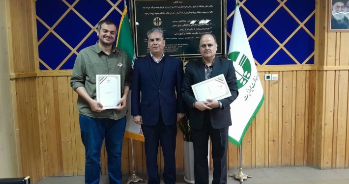
In February 2025, AvayeBoom Bird Conservation Society and Iran’s Department of Environment entered a formal one-year agreement to develop three national technical guidelines:
Birdwatching in areas managed by the Department of Environment
Use of drones around birds and wildlife in protected areas
Release of rehabilitated birds
I was selected as the focal person responsible for managing the work from both AvayeBoom and the Department of Environment side.
That role placed me between the NGO team, wildlife specialists, protected-area staff, government offices and other contributors involved in reviewing and turning the technical material into documents that could function within the Department’s national system.
How we developed them
The starting point for each guideline was a combination of scientific literature, international guidance, existing regulatory approaches and practical experience from the field.
We then had to translate that material into the Iranian conservation system.
A recommendation that works scientifically still has to make sense for rangers, provincial offices, wildlife rehabilitation centres, researchers, birdwatchers, filmmakers and people responsible for issuing permits. That meant repeated drafting, technical review, institutional comments and revision.
For me, this was one of the most interesting parts of the project. Writing guidance is different from writing a scientific paper. The final text has to survive contact with real decisions.
Releasing rehabilitated birds
Bird rescue and rehabilitation is widespread in Iran. Birds reach government facilities, NGOs, veterinarians and individual rehabilitators after collisions, shooting, illegal captivity, poisoning, exhaustion and other injuries.
The final stage, returning a bird to the wild, can determine whether that rehabilitation has actually succeeded.
The release guideline therefore addressed questions including health and fitness assessment, appropriate release timing, selection of release sites, species-specific considerations and post-release monitoring.
It also created a more consistent framework for deciding when a bird is ready for release and how that release should be planned.
This was the first of the three documents to complete the institutional process.
The National Guideline for Releasing Rehabilitated Birds was formally issued on 3 May 2026 by Iran’s Department of Environment.
For me, that was an important point in the project: something developed jointly between a conservation NGO and the national authority had moved from working drafts and expert discussion into an official national technical standard.
Drones and wildlife
The drone guideline grew from a conservation problem I had already been concerned about for several years.
Drones have become increasingly useful for research, mapping, monitoring and environmental documentation. At the same time, close or repeated flights around wildlife can produce disturbance, changes in behaviour, interruption of feeding and resting, abandonment of sensitive areas, and particularly serious impacts around nests, breeding colonies and young animals.
The problem was therefore not simply whether drones should be used. It was how their use could be managed according to ecological risk.
The guideline developed a national framework for reviewing and permitting drone operations in areas managed by the Department of Environment. It covers activities including research, monitoring, mapping, photography, filming and content production.
From a general permit to ecological conditions
One of the important changes in the drone work was treating wildlife sensitivity as part of the permitting decision itself.
The draft distinguishes routine applications from activities requiring additional specialist review, including work involving threatened or range-restricted species, breeding periods, nests, breeding colonies, roosts and other sensitive parts of the life cycle.
It also establishes principles around minimum disturbance, flight duration, approach to wildlife, operator responsibility, supervision, data protection and the ability of environmental authorities to stop an operation if wildlife is being affected.
The drafting process expanded beyond AvayeBoom and the Wildlife Conservation and Management Office. Specialists from other Department of Environment offices and the national aerial monitoring working group also contributed to the document.
By 2026, the guideline had reached an advanced institutional stage and was moving through the final process towards formal issuance.
Birdwatching in protected areas
Birdwatching has been part of my own work for much longer than most of my conservation projects. I have taught it, guided it, managed a birdwatching centre and used it as a tool for public engagement and research.
That experience also makes its conservation risks very clear.
A group of birdwatchers approaching a breeding colony, remaining too close to a nest, repeatedly entering a roost or pursuing a rare bird for a better photograph can create the same disturbance that birdwatching is supposed to teach people to avoid.
The national birdwatching guideline was developed to provide a more consistent framework for birdwatching in areas managed by the Department of Environment.
Its scope includes access and permissions, behaviour around nests and roosts, selection of appropriate locations, disturbance minimisation, responsible observation and the development of birdwatching in ways compatible with conservation management.
This guideline remains in the institutional process.
Three documents, one underlying problem
Although the three guidelines deal with very different activities, I see them as parts of the same conservation problem.
Bird conservation often depends on decisions made at the point where people interact directly with wildlife: somebody deciding how close to approach, whether to fly, where to release an animal, when to enter a sensitive area, or whether an activity should receive permission.
Those decisions become much less dependent on individual judgement when there is a shared technical framework behind them.
That is what I wanted these guidelines to contribute.
My role
My responsibility extended beyond drafting text.
I coordinated the overall programme, organised the evidence review, connected contributors from AvayeBoom and the Department of Environment, followed the documents through technical and institutional review, incorporated comments and worked to keep the ecological purpose of each guideline intact as it moved through an administrative system.
That process gave me a much closer view of how conservation knowledge becomes policy and operational guidance.
A technically strong document is only part of the work. It also has to fit institutional responsibilities, define who makes decisions, establish a workable process and become usable by the people expected to implement it.
Where the project stands
As of 2026:
National Guideline for Releasing Rehabilitated Birds
Officially issued on 3 May 2026.
National Guideline for the Use of Drones in Department of Environment-managed Areas
Advanced draft completed and in the final institutional process.
National Guideline for Birdwatching in Department of Environment-managed Areas
Under institutional review and development.
Reforming Songbird Trapping Permits in Iran
Iran · 2026 · Policy Lead
An old permit system
Iran has had a legal framework for trapping and keeping songbirds for decades. The broader permit architecture dates back to the late 1960s, while the specific system used for small passerines had continued for many years with relatively little structural reform.
In principle, permits were intended to regulate limited capture. In practice, the system had become increasingly difficult to monitor.
Provincial offices could issue permits specifying particular periods and quantities, but enforcement officers had very limited ability to verify where birds had actually been captured, how many had been taken, or whether birds in transport or trade had come from permitted activity.
That gap between regulation on paper and what could actually be verified in the field became the central problem.
What we were hearing from the field
The issue had been visible for years through conversations with rangers, wildlife experts and people working around bird trapping and trade.
One of the strongest concerns was that a valid permit could sometimes make enforcement more difficult rather than easier.
A person found carrying or selling wild-caught songbirds could present a permit, while an officer had little practical way to establish whether those particular birds had been captured within the permit conditions.
This mattered because trapping itself often happened outside protected areas and away from direct supervision.
The problem therefore extended beyond illegal trapping. It was also about the design of a legal system whose conditions were extremely difficult to verify once birds had entered transport and trade.
A problem across several provinces
The evidence we encountered was not confined to one locality.
Field observations, enforcement reports and discussions suggested a broader geographic pattern extending through parts of northern, central and southwestern Iran, including provinces such as Mazandaran, Alborz, Tehran, Markazi, Qom, Isfahan, Fars and Khuzestan.
The scale and form of trapping varied between places, but the same governance problem appeared repeatedly: a legal permit system existed alongside illegal capture, movement and sale of birds.
That made it a national policy issue rather than a problem that could be solved by one provincial office.
The enforcement paradox
One part of the system was particularly interesting to me.
Permits could create legal cover that made enforcement harder, but some licensed trappers also had an informal role in identifying people trapping without permits.
In other words, the same system could simultaneously weaken formal enforcement and support informal enforcement.
This was an important reason not to treat the problem as simply “permits are bad” or “enforcement is weak”.
The system had developed its own social and institutional relationships over decades. Changing it meant understanding what functions it was actually performing, including unintended ones.
Building the evidence
In late 2025 and early 2026, we began consolidating the issue more systematically at AvayeBoom.
We held discussions with provincial Department of Environment offices, particularly in Isfahan, Fars and Mazandaran, and spoke with wildlife experts and enforcement personnel about how the permit system worked in practice.
We combined these accounts with long-term field observations, publicly documented enforcement cases, legal and administrative material, and our own experience working with bird conservation across different provinces.
By January 2026, we had brought that information together into a policy case.
Moving into the formal process
The next step was formal rather than public advocacy.
AvayeBoom submitted a written policy request to Iran’s Department of Environment, setting out the problems with monitoring and compliance verification and proposing that the permit system should be reassessed.
I led the policy engagement from the NGO side, including the evidence consolidation, formal correspondence, institutional discussions and development of the recommendations.
The issue then moved through the Department’s internal review and consultation process.
The decision
In February 2026, Iran’s Department of Environment decided to suspend the issuance of songbird trapping permits for five years.
The decision was subsequently communicated to provincial offices for implementation.
I think the time-limited nature of the suspension is important.
A five-year suspension creates a period in which the ecological and enforcement effects of removing the permit system can be observed. It also creates space to determine whether the previous system should eventually be permanently discontinued, fundamentally redesigned or replaced with a different regulatory approach.
Why I see this as an adaptive policy intervention
I do not see the suspension as the end of the project.
Removing a problematic permit system may reduce one enforcement loophole, but it can also create new dynamics. Illegal trapping may decline, remain unchanged or become more difficult to detect. Trade routes may shift. Enforcement relationships may change.
The five-year period therefore needs monitoring.
Useful indicators would include trapping activity, seizure records, trade patterns, enforcement outcomes and feedback from provincial wildlife offices and rangers.
The long-term policy decision should be based on what happens during this period rather than simply assuming that suspension alone solved the problem.
From field knowledge to national policy
This project reinforced something that has become increasingly important in my work: conservation policy can fail even when its stated objective is reasonable.
The original permit system was intended to regulate trapping. The deeper problem was that its rules had become difficult to monitor, verify and enforce under real conditions.
That distinction matters.
A conservation regulation should not only describe what is allowed. It has to work at a checkpoint, in a market, in a provincial office and in the field where enforcement actually happens.
For me, this project was an example of how information held by rangers, provincial experts and conservation practitioners can be turned into a national policy question when it is documented and brought into the formal decision-making system.
Policy output
Ebrahimi, I., & Kazemi, F. (2026).
Reforming Songbird Trapping Permits in Iran: A Policy Brief.
AvayeBoom Bird Conservation Society.
Homa Environmental Grant
Iran · 2025–present · Manager
Why Homa
For years, I had been on the other side of conservation funding: developing projects, looking for resources, trying to fit local problems into grant frameworks, and seeing good ideas stop because relatively modest financial support was unavailable.
That experience shaped Homa.
I founded the Homa Environmental Grant as a funding programme for people and organisations working on practical environmental problems in Iran. The aim was to create a route through which a strong conservation idea could move from a proposal into implementation, with enough financial, technical and strategic support to give it a realistic chance of succeeding.
I was particularly interested in projects that could show what changed because the work happened. For me, funding conservation should eventually lead back to evidence: a species better protected, a threat reduced, a community more capable of managing a problem, or a conservation system that functions better than it did before.
Building the programme
Homa had to be designed as more than an open call followed by a funding decision.
I developed the programme structure, call for proposals, assessment process, selection criteria and approach to supporting funded teams. My role has included proposal review, coordination of the expert panel, grant selection, allocation of resources, mentoring, project monitoring and evaluation, and the longer-term development of the programme.
The selection process was designed to look at conservation significance and practical quality together.
Projects were assessed for the importance of the environmental problem they addressed, the clarity and measurability of expected outcomes, stakeholder participation, scientific basis and innovation, feasibility, and the likelihood that useful results could continue beyond the funded period.
Where promising proposals had weaknesses that could realistically be corrected, applicants were given an opportunity to revise them rather than being removed immediately from consideration.
The first call
The response to the first Homa call was much larger than I had expected.
More than 56 environmental proposals entered the assessment process from teams working on different conservation problems across Iran.
The first stage involved screening proposals for basic eligibility, conservation relevance and project quality. Stronger proposals then moved through more detailed technical assessment and discussion by an expert panel.
The final selection required comparing projects that were often addressing completely different environmental problems. A marine conservation project could be competing for the same limited resources as forest restoration, community-based fire management or wildlife conservation.
That made the quality of the selection framework especially important.
Three projects
Three principal projects were selected in the first cycle.
The first focuses on using local ecological knowledge to improve the study and conservation of marine mammals in Hormozgan Province. The project works across coastal and island communities to document observations, seasonal patterns, distribution and interactions between people and marine mammals.
The second focuses on forest restoration, wildlife recovery and local livelihoods in the Chelav landscape of Mazandaran. It combines wildlife monitoring, local participation, habitat management and work on livelihood pressures affecting the forest.
The third is a community-based wildfire management programme in the Zagros forests, designed around local capacity for prevention, preparedness and rapid response to fire.
I liked the fact that the three projects were so different. Together they covered marine conservation, forest and wildlife restoration, and a landscape-scale environmental threat, while all requiring meaningful participation from people living in the landscape.
Funding the work
The principal Homa grants were designed to provide substantial enough support for a conservation team to implement a defined project rather than simply finance a small activity.
Selected principal projects could receive support of up to 500 million tomans.
Homa also created space for smaller environmental projects, with a separate level of support of up to 50 million tomans, as well as the possibility of supporting environmental technology projects where the needs and potential impact justified a different approach.
The point was to keep the programme flexible enough to support different scales of conservation work while still requiring a clear problem, a credible intervention and measurable outcomes.
Support beyond money
One decision I made early was that Homa would stay involved after the grant was awarded.
Funding is often only one of the things a conservation team needs. A technically strong group may still need help refining indicators, designing monitoring, structuring implementation, communicating results or responding when the original plan encounters problems in the field.
The selected teams therefore receive mentorship and project support throughout implementation, alongside financial support.
My role continues during this stage. I work with teams on project design, monitoring and evaluation, conservation logic and practical decisions that emerge during implementation.
Media and communication support are also part of the programme, so that useful conservation work has a better chance of being documented and reaching audiences beyond the project team.
What I look for in a project
Directing Homa has changed the way I assess conservation projects.
A proposal can be beautifully written and still have a weak conservation mechanism. A technically interesting intervention can fail because the people who determine its success were never included. A large project can produce less conservation value than a small intervention placed at exactly the right point in a system.
I therefore tend to look first for the chain between problem, intervention and measurable change.
I want to understand what the team believes is causing the conservation problem, what exactly they intend to change, why the proposed intervention should produce that change, and how we will know whether it happened.
The budget and activities make more sense once that chain is clear.
Learning from other conservationists
Homa has also given me access to a perspective I rarely had while leading my own projects.
Through a single call, I can see how dozens of conservationists in different parts of Iran define problems, design interventions and work with communities, government agencies, species and landscapes.
Reviewing those proposals has been useful in itself.
It shows where conservation capacity is strong, where teams repeatedly struggle, which kinds of support are missing, and where relatively small amounts of money can unlock work that already has strong local knowledge and commitment behind it.
The programme therefore functions for me both as a funding mechanism and as a way of understanding the broader conservation system.
A change in my own role
Homa also represents an important transition in my career.
For most of my conservation work, I was the person designing and leading the project directly. I was responsible for the field team, implementation, stakeholders and eventually the results.
With Homa, my responsibility is different.
I am helping other conservationists do that work.
That means deciding where limited resources can have the greatest value, helping teams improve their thinking without taking ownership of their projects away from them, and creating a system in which good conservation work can grow beyond the organisations and projects I personally lead.
For me, that shift from leading projects to also enabling other people to lead them is one of the most important developments in my work over the past few years.
Current work
The first Homa projects are now in implementation, with monitoring and mentorship continuing through the grant period.
The longer-term goal is to develop Homa into a durable funding mechanism that can support conservation work across Iran while gradually improving how projects are selected, designed, evaluated and documented.
I want the programme to build more than a portfolio of funded projects. Over time, it should also strengthen the capacity of the people and organisations behind them.
Selected projects, first cycle
Local ecological knowledge for the study and conservation of marine mammals in Hormozgan Province
Midaf Nature Conservation Association
Forest restoration, wildlife recovery and local livelihood improvement in Chelav, Mazandaran
Chelav Wildlife Support Institute
Community-based wildfire management in the Zagros forests
Green Zagros Movement